So. Unless you’re living under a rock, you’ll know that Google StreetView has now indexed Australia. At first I thought it was only the cities – I idly looked up my place (feeling vaguely uncomfortable), and some places I lived growing up, and had a peek at the Perth CBD.
Then I realised they’ve also photographed a fair whack of the countryside, too. And not just the easy parts. They didn’t stint on crossing the Nullarbor:

And quite a bit of the North is in there, though up in some areas of Queensland they had trouble keeping the red dirt off the lens.

As a kid fascinated by maps, I would spend time absorbed in the street directory. (This lay in constant tension with my tendency to carsickness.)
I was always drawn to the LIMIT OF MAPS. I would trace the edge of the LIMIT OF MAPS around, wondering what lay beyond, and why it wasn’t worth mapping, while this page was.
Google Streetview has suddenly taken this preoccupation to a whole new level.
Some of the end-of-line areas I found were logical terminators – car parks, bluffs. Other places, however, they seem to have stopped because they were driving deep into the sunset of nowhere, or because the road was getting muddily or sandily impassable, or perhaps because they were going close to Aboriginal land without a permit, or just … because.
Here’s a whip-through of some LIMIT OF MAPS spots that caught my eye around the country. (Links are not exact, but are a clue to the general area.) I’m kinda expecting myself to be the only person interested, but you never know – the internet is a very big place, and obscure kindred spirits arise unexpectedly.
Cascade, north of Coomalbidgup, out of Esperance

North of Neridup

Fitzgerald River National Park

East of Grass Patch

Hyden-Norseman Road

Out of Leinster

East of Wiluna

Out of Gascoyne Junction

Mullewa Carnarvon Road

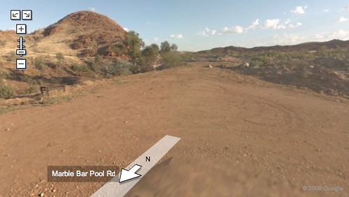
Out of Marble Bar
Out of Exmouth

Northwest Cape

Mof Rd, Burrup Peninsula (anyone know what this “port security area” is?)

North of Broome

East of Derby

Out of Wyndham – I can see why the Googlemobile didn’t continue!

North of Kununurra – things are looking muddy.

Road to Papunya

Road to Yulara

Watarrka National Park

Out of Cooktown, Far North Queensland

Back O’ Bourke

Mount Buller

Tasman National Park

And – Cape Bruny, near the southernmost tip of Tasmania.

Categories: arts & entertainment, Life, technology

And yet it des not cover my street in inner west Sydney. Or my part of the (short) street, it covers one end, and the other but nothing for the 20 metres in between where I am. But I’ve enjoyed a tour of my childhood houses and schools.
No no, I have a similar interest and surprise at the length of mapping in Streetview!! I looked up the house I grew up in (my parents only moved last year), which is in a town of 550 people but on the Pacific Highway – small, but not out of the way, necessarily. I didn’t really expect it to be on there (I was testing googlemaps), but it was – from three angles! (it’s on a corner).
I was even more surprised when I followed the street it’s on out of town… there’s nothing but canefields at the end of my street… and it gave me the option to turn left, on the road that goes only to the beach and to the next town, which is 10 k’s to the south, and it’s all bush. Amazing.
Amanda, I’m really sorry, but I have to say this: if they’re not doing every road in the whole country, why should they do every road in a city? I think the idea is to help people get near to stuff. I mean, they haven’t done my parents’ new street in Lismore, for example, but I wasn’t surprised: I figured that since the streets a couple of blocks away were done, it was meant to be a guide to the area, not an exhaustive record.
One country town I lived in for a while, we lived right on the edge of the built-up part of town – the next blocks were still farmhouses on acreage. It’s all been subdivided now.
There seem to be a few mapping gaps near military barracks etc, and fair enough. They’re not making it obvious, but if one knows that the installation is there one can see that certain nearby streets which might overlook certain parts of the installation don’t have streetview images.
I am not demanding it as a human right, it’s just odd.
There’s no streetview of my apartment in the U.S., but I did find my old apartment in West Sydney! LOOK THAT’S THE ENTRANCE TO MY OLD GARAGE. And there’s the drug rehab center and homeless hostel just a couple doors down! Oh, my favorite coffee shop! And why the hell does the ice cream shop where I used to work look like it’s shut down???? It can’t be!
Okay I’ll stop now. But this is fun. Thanks. I miss Oz.
Although my house in Cremorne, Melbourne, is normally clearly visible from the street it isn’t showing up on Street View – just before you reach my house the map hilariously jump-cuts to a view of the inside of the Burnley Tunnel, which runs directly under my house. 🙂
Apparently I was born in a paddock. ‘ow far I ‘ave risen from such ‘umble origins.
Amandas last blog post..DailyLit
The street I lived on as a kiddie in the 70’s was right on the limit of the street directory, as it butted up against a bushland reserve in Westleigh (Northwestern Sydney). I just had a look at Streetview and it hasn’t changed that much…brought back many fond memories of fleeing bushfire that came from beyond the limit of the map, and returning to discover the house intact but covered in ash.
On the recommendation of Down and Out of Saigon, I zoomed out and looked at the blue worms across the whole nation. Pretty neat.
Here’s the turn-off to Pine Gap:
Googling through Wittenoom was pretty sad.
And they don’t always blur the bottom part of the image:
I’m kinda expecting myself to be the only person interested, but you never know – the internet is a very big place, and obscure kindred spirits arise unexpectedly.
You’re not the only one. I’ve been wasting a few hours viewing obscure parts of this continent. It’s a real eye-opener seeing how dry and arid most of Australia is. I’ve driven outback Queensland or have been driven, but one forgets what it is like to be in the thick of it when one lives in the big cities. Flying over doesn’t count.
And you checked Wittenoom too? I hope the Googlemobile had air filters.
I love this post!
The in-laws were visiting the day they came to our place, their car is out the front.
A fair bit of Australia is green and gorgeous in wintertime, but they seem to have done most of the surveying in summer, when we go brown and arid. And, on the other hand, a fair bit of Australia is completely drenched in summer – but they didn’t go into the North much at all, possibly because much of it would be impassable by Googlecar in the Dry, let alone in the Wet.